
Open/Close Dates
- 12″ rule
- No open/close dates
Avalanche Conditions
Colorado Avalanche Information Center
Avalanche.org
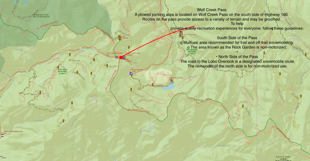
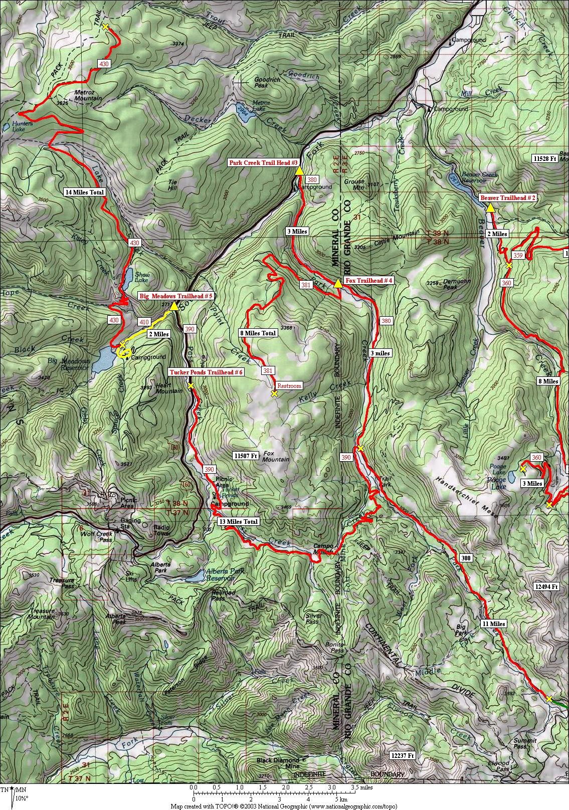
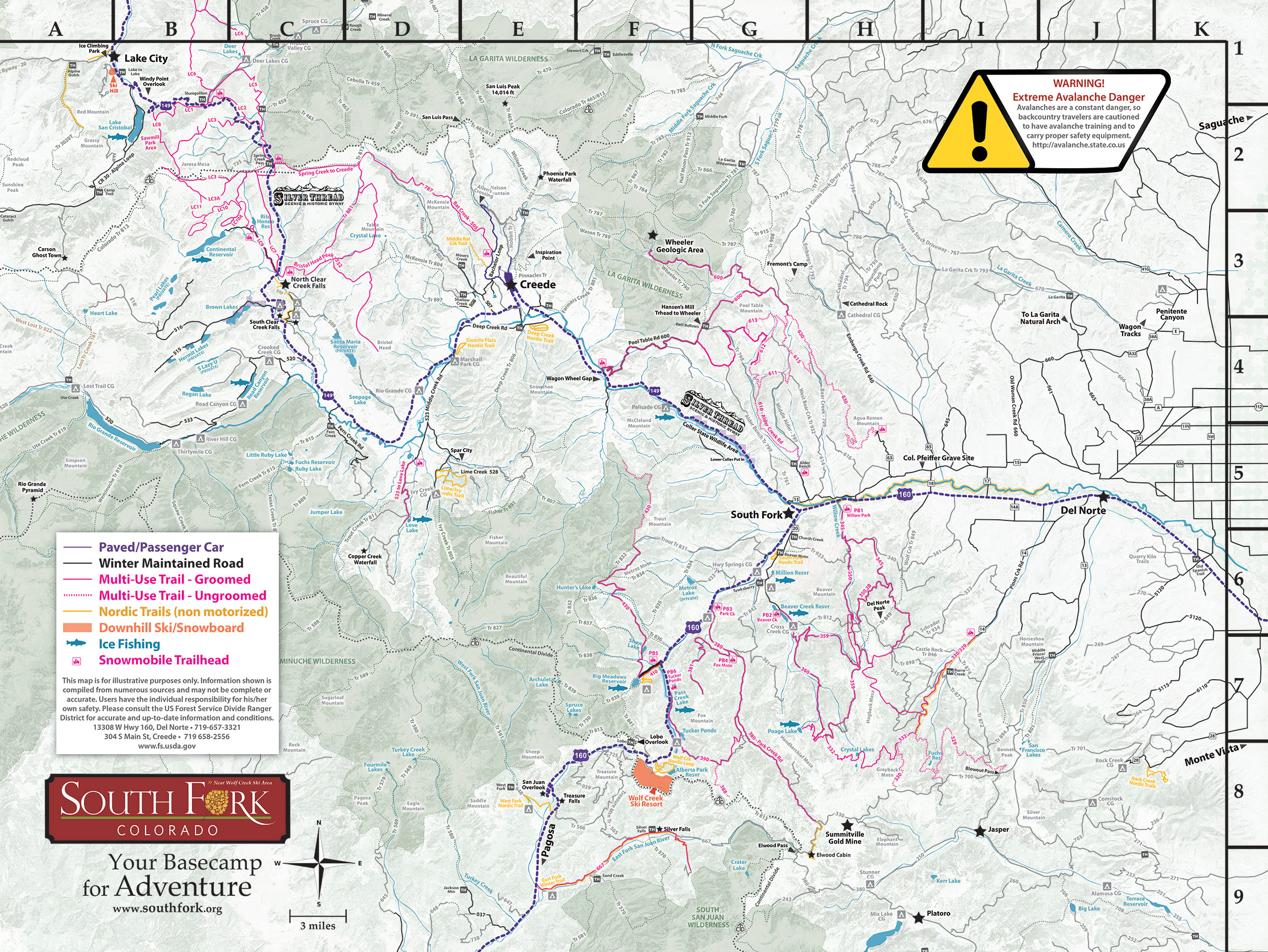
Trail Map
Web Cams


Snotel
- Wolf Creek Summit 10957 ft
- Upper San Juan 10140 ft
- MAP
Weather
Search & Rescue

Mineral County Search & Rescue
Call 911 or (719) 658-2600

Rio Grande County Search & Rescue
Call 911 or (719) 657-4000
Call 911 or use your satellite communications device
Snowmobile Clubs


Parking
User Permits
Get Permits NowProducts & Services
Your one stop shop for aftermarket
snowmobile parts and accessories
Mountain Side Performance
Kremmling, CO
(970) 406-2722


Marlenee LLC Excavation & Marlenee Photography
6790 Hillside Drive
Idaho Falls, ID 83401
(970) 227-7977